Edmonton is known for its natural attractions, urban green spaces, and beautiful amusement parks.
Exploring hiking and walking trails is an immersive and adventurous way to connect with the city’s diverse and scenic landscapes.
Whether going on a short road trip or holiday vacation, you can include popular trails in your itinerary. Step out onto one of Edmonton’s top trails for hiking and walking.
1. Mactaggart Sanctuary Path
Source: Foursquare
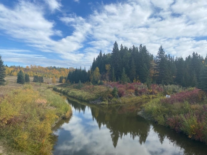
Mactaggart Sanctuary Path is a protected nature reserve at the fork of Blackmud Creek and Whitemud Creek. It was donated by Sandy A. Mactaggart to Edmonton and made available for the public’s enjoyment.
The route is considered easy to moderately difficult because it has little elevation gain and a fairly short trail. However, the rugged sections and small hills on the track make this trail quite challenging.
Whitemud Creek winds through Mactaggart Sanctuary Park. To get across it, you must use the ladders and ropes in the area.
After you cross the creek, you’ll see why many visitors claim that the hike was well worth it. The trails are a sanctuary for different bird species, diverse plants, and other wildlife.
Since there are many steep inclines and declines on the trail, it’s best to wear your hiking shoes. Moreover, don’t forget to bring some bug spray and mosquito repellent because you’ll meet a lot of bugs along the way.
2. Whitemud Creek Ravine Trail
Source: River Valley Alliance
Whitemud Creek Ravine Trail is one of the most visited trails in Whitemud Ravine Nature Reserve. It has many twists and turns, so it’s recommended for hikers who want a bit of a challenge.
Although the trails are moderately flat, there are several inclines, dirt paths, and gravel paths that can make the trails challenging for beginners.
On average, people can complete the route in more or less than two hours. Whitemud Creek Ravine has wider trails than other trails in Whitemud Creek, so many families prefer to walk or hike here.
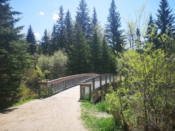
Don’t forget to bring your camera and gear when you hike so you can snag some instagrammable pictures of the area’s rich foliage, flowers, and trees.
Aside from scenic river views, it also features several bridges, making it an excellent spot for walks. If you’re fortunate, you can even say hello to some deer or moose during your stroll.
You can’t bring your bike on this trail, but you can come with your dog! Just remember to put them on a leash so you can explore the track safely.
3. Bunchberry Meadows Outer Loop
Source: Wildlife Preservation Canada
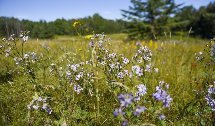
Bunchberry Meadows is a conservation area set outside downtown Edmonton. It has well-marked trails and is not as congested as other popular trails.
The conservation site is also equipped with picnic tables, pit toilets, and a parking lot for your convenience.
If you’re a beginner in hiking and you want to take your hike’s difficulty level up a notch, the Bunchberry Meadows Outer Loop trail should be on your list. In general, hikers accomplish the route in 1 hour and 34 minutes.
It’s a good go-to spot because you can immerse yourself in nature’s beauty without worrying about a flock of tourists coming your way. Moreover, its terrain is also great for cross-country skiing and snowshoeing during winter.
Since it features old-growth forests, wetlands, and open meadows, you can meet a range of wildlife species such as squirrels, owls, hawks, porcupines, and weasels.
4. Beaver Hill Loop
Source: Alberta Parks
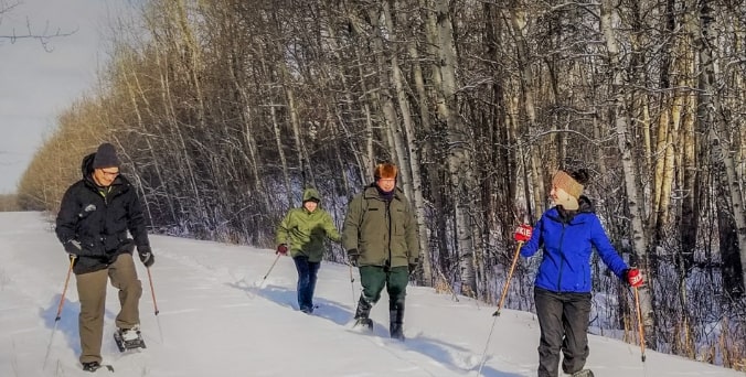
Beaver Hill is a rolling upland region in Edmonton that consists of knob and kettle terrains. This means that the area is filled with rounded hills and small lakes.
Due to that, Beaver Hill Loop is a bit inclined and muddy on some sections. Be prepared and wear the right clothing and footwear for hiking.
Since it’s part of the Elk Island National Park, this trail is protected and relatively undeveloped, so it’s recommended for wildlife viewing. True to its name, you can spot some beavers along the way.
It’s open throughout the year, but hikers recommend exploring the trail in warm months so you can enjoy birdwatching, fishing, and camping.
5. Wolf Willow Stairs
Source: River Valley Alliance
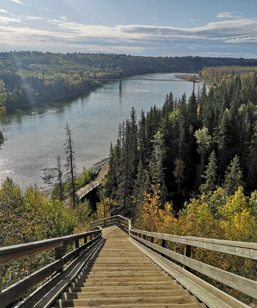
Wolf Willow Stairs is a trail in Westridge Park. It’s a famous trail for walks because the area is partially paved and relatively shorter than other trails.
This trail is a good alternative to your step climber at the gym because you’ll get to exercise and admire nature’s beauty simultaneously. When you reach the top, you can take in the panoramic views of the North Saskatchewan River.
The trail is generally considered easy because you just need to climb over 200 steps. However, it’s one of the city’s steepest stairs, so you must be careful with each step.
If you want to take a break halfway, you can relax for a while on the benches set at the middle and top part of the stairs.
Alternatively, if you feel like you can walk more, you can extend your trip to Fort Edmonton Bridge or Terwillegar Park and just double back.
Remember that the parking spot near the top of the stairs is only for the residents of the neighborhood. For this reason, if you’re bringing your vehicle, it’s best to leave it in the parking lot across the river or other nearby spots.
6. Terwilliger Footbridge and West End Trails

Source: Terwilliger Footbridge and West End Trails
Terwilliger Footbridge and West End Trails is a 7 km trail that is wide and paved with large staircases at the end which is an ideal place to start for beginner to moderate difficulty hikes.
We like that the trail allows bikes and dogs so that hikers will have more adventurous and fun options to take with them on their next hiking journey at the said trail.
The trail also features a parking lot for the convenience of hikers who used their vehicles in going to their trail and to ensure that it is also secure and intact upon their return as well.
There aren’t guided hike packages readily available so interested individuals may need to rely on their virtual maps and instructions that are readily available on their website for reference.
Overall, with its scenic bridge and seemingly rural aesthetic, and convenient amenities, we highly recommend them to individuals who would like to bring their dogs or experience biking along the trail for a wonderful and fresh experience to try this out.


